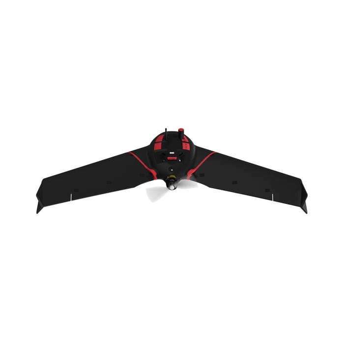
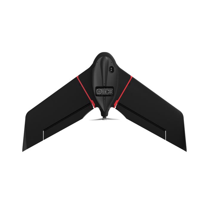
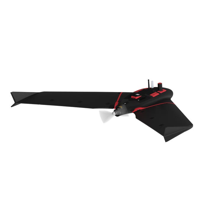
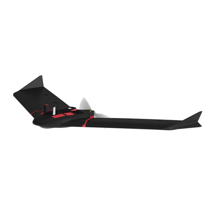
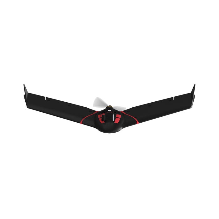
Skip to product information
1 of 6

AgEagle

senseFly eBee Ag

senseFly eBee Ag

Regular price $1.00 USD
Regular price Sale price $1.00 USD
Sale Sold out
Shipping calculated at checkout.

DESCRIPTION

How To Get A Quote:

Option 1:
Contact Us to make sure you are getting the best unit possible. These machines are complex so let us help you get exactly what you need!

Option 2: (quickest response times)
Step 1. Add the item to your cart
Step 2. Checkout or Click on the Chat button box that is at the bottom right of your screen
Step 3. Please tell us any info you think we would need to know
Step 4. Relax, our team is processing your request and an expert will be in touch to get you exactly what you need!

  • Up to 55 minutes flight time
  • Down to 2.5 cm absolute accuracy with RGB
  • Optimized multispectral outputs
  • Lightweight and durable
  • Safe and easy to use

Precision agriculture is revolutionizing the way farmers manage their crops, and the senseFly eBee Ag is leading the charge. This innovative drone captures accurate RGB and multispectral data from the sky, allowing farmers to make more informed decisions about their crops. By regularly collecting multispectral data, farmers can more effectively assess crop health, optimize input use, and catch early indicators of pests, diseases, and weed infestations that threaten crop yields. With the senseFly eBee Ag, you can make your farm more productive and efficient than ever before.

User-friendly agricultural drone

The senseFly eBee Ag, which is user-friendly and reasonably priced, assists farmers, agronomists, and service providers in effectively capturing aerial data and insights regarding plant health for quicker agronomic decision-making that can increase crop yields and profit potential.

The senseFly eBee Ag drone, based on the company's flagship eBee X model, aids agricultural experts in overcoming the numerous difficulties they encounter in the field with regard to planning, plant health, and crop monitoring. Field scouting, verifying potential issue areas, and obtaining essential crop health and field information is now more straightforward than ever, thanks to eBee Ag.

For frequent and intensive crop mapping operations, eBee Ag is the right tool. With its standard battery, it can fly for up to 45 minutes. With an endurance battery, eBee Ag can fly for up to 55 minutes, which lets it cover more than 160 hectares (395 acres) in a single flight and save time and money compared to traditional scouting.

Duet M payload

eBee Ag has the new, light Duet M dual-sensor fixed payload from senseFly. It has the senseFly S.O.D.A. RGB camera and the Parrot Sequoia+ multispectral camera. The eBee Ag's dual-purpose camera accurately gathers RGB and multispectral data from the sky to aid in better decision-making on the ground. Multispectral data collection is essential to assess crop health accurately, optimize inputs, and detect early signs of the pest, disease, and weed infestations that threaten agricultural yields. Agriculturists may manage troublesome regions over the entire field with the help of highly precise index maps, addressing them before they have an influence on revenues.

Real-Time Kinematic (RTK) capabilities

The eBee Ag also offers Real-Time Kinematic (RTK) capabilities for improved mapping accuracy. eBee Ag can achieve absolute precision with RGB down to 2.5 cm (1 in) thanks to its optional RTK. After that, current GPS-enabled machinery and/or Farm Management Systems may easily integrate this position data.

Additionally, senseFly's new eBee X series backpack, an innovative and reliable way to carry everything required to transfer the drone into and out of the field, is included with eBee Ag.

The eBee Ag is related to senseFly's eBee X fixed-wing mapping drone, which revolutionized the unmanned aerial vehicle industry with its user-friendliness and array of cutting-edge sensors. The eBee X is a premium solution that offers users the high-precision of on-demand RTK/PPK for achieving absolute accuracy of down to 1.5 cm (0.6 in) - without ground control points. It has a unique Endurance Extension option that enables a flight time of up to 90 minutes and single-flight coverage of up to 500 ha at 122m (1,236 acre/400 ft.).

eMotion flight planning software

Enterprise organizations that purchase eBee Ag or any other drone from the eBee X line gain access to senseFly's user-friendly eMotion flight planning software, technical support, and resource offerings, including its in-house team of experts, global distribution network, and the recently launched senseFly Academy e-Learning Training Platform and Certified Operator Program. Farmers, agronomists, and other professionals in the agriculture industry can also purchase eBee Ag.

SPECIFICATION

Results

  • Ground Sampling Distance (GSD) at 122 m (400 ft): 2.8 cm (1.1 in)/pixel RGB, 11.5 cm (4.5 in)/pixel Multispectral
  • Absolute horizontal/vertical accuracy (w/GCPs): Down to 3 cm (1.2 in) / 5 cm (2 in) 
  • Absolute horizontal/vertical accuracy (no GCPs): 1 - 5 m (3 - 16 ft)
  • Lowest Ground Sampling Distance: 1.1 cm (0.4 in)/pixel
  • Absolute X, Y, Z accuracy (RTK/PPK activated): 2.5 cm (1 in) on the senseFly S.O.D.A. data RTK only

Hardware

  • Wingspan: 116 cm (45.7 in)
  • Weight (incl. camera & battery): 1.3 kg (2.2 lb)
  • Electric motor: Low-noise, brushless
  • Radio link range: 3 km nominal (up to 8 km) / 1.9 mi (up to 5 mi)
  • Detachable wings: Yes
  • Cameras (supplied): senseFly Duet M
  • Cameras (optional): There is no other camera compatible with eBee Ag
  • GNSS grade: Survey
  • Carry backpack dimensions: 75x50x29 cm ( 30x20x11 in)
  • Backpack weight (empty): 4.6 kg (8.8 lb)
  • Carry case dimensions (optional): 75x48x33 cm (30x19x13 in)

Software

  • Flight planning & control software (supplied): eMotion
  • Automatic 3D flight planning: incl. in eMotion 3
  • 3D environment: Yes
  • Photogrammetry software (optional): Pix4Dmapper/Pix4Dfields, Agisoft PhotoScan, DroneDeploy
  • Vegetation index calculation (w/optional photogrammetry software): Yes
  • CAD / GIS (optional): --

Operation

  • Cruise speed: 40-110 km/h (11-30 m/s or 25-68 mph)
  • Wind resistance: Up to 46 km/h (12.8 m/s or 28.6 mph)
  • Maximum flight time: 45 to 55 minutes depending on battery
  • Endurance extension available (fly more than 60 minutes): No
  • Nominal coverage at 120 m (400 ft): 160 ha (~395 ac) with Standard battery
  • Maximum coverage at 120 m (single flight): 200 ha (~494 ac) with Endurance battery
  • Max. flight range: Standard: 30 km (~19 mi), Endurance: 36 km (~22 mi)
  • Post-processed kinematic (PPK): No
  • Real-Time Kinematic / Virtual Base Station: Yes
  • Real-Time Kinematic / Base Station Unknown point: Yes
  • Real-Time Kinematic / Base Station Known point: Yes
  • Ground control points (GCPs): Not required
  • Oblique imagery: No
  • Hand launch: Yes
  • Landing: Automatic Linear landing (5 m/16.4 ft accuracy in 20° angle cone)

senseFly Duet M Camera

  • Sensor: Multispectral (Parrot Sequoia+) and RGB (senseFly S.O.D.A.)
  • RGB lens: f/2.8-11, 10.6mm (3 mm equivalent: 29mm)
  • Multispectral bands: Green (550nm +/- 40nm), Red (660nm +/- 40nm), Red edge (735nm +/- 10nm), Near infrared (790nm +/- 40nm)
  • RGB resolution: 5,472 x 3,648 px (3:2)
  • Multispectral resolution: 1.2 MP, 1,280 x 960 px
  • RGB shutter: Global Shutter 1/30 - 1/2000s
  • White balance: Auto, sunny, cloudy, shady
  • ISO range: 125-6400
  • Multispectral shutter: Global
  • Single-band FOV: HFOV: 64 Degree, VFOV: 50 Degree, DFOV: 74 Degree
  • Calibration: Automatic radiometric calibration
  • Support RTK/PPK: Yes
  • Format: RGB: JPEG, Multispectral: TIFF

WHAT IS IN THE BOX Hide

  • 1x eBee Ag drone
  • 1x senseFly Duet-M camera
  • 1x Ruggedized backpack
  • 2x Spare propellers
  • 10x Spare propeller attachment rubber bands
  • 2x Standard eBee Ag Li-Po batteries
  • 1x Li-Po battery charger
  • 1x Spare Pitot Kit
  • 1x USB Ground Modem
  • 1x USB Cable

 Hide

View full details