


Compatible with most processing software
PIX4Dmapper, PIX4Dmatic, PIX4Dcloud, PIX4Dreact, PIX4Dfields, PIX4Dsurvey, Agisoft Metashape, DroneDeploy, Bentley ContextCapture, SimActive, Esri ArcGIS Drone2Map and Trimble Business Center.
AgEagle
Couldn't load pickup availability
How To Get A Quote:
Option 1:
“Contact Us to make sure you are getting the best unit possible. These machines are complex so let us help you get exactly what you need!
Option 2: (quickest response times)
Step 1. Add the item to your cart
Step 2. Checkout or Click on the Chat button box that is at the bottom right of your screen
Step 3. Please tell us any info you think we would need to know
Step 4. Relax, our team is processing your request and an expert will be in touch to get you exactly what you need!
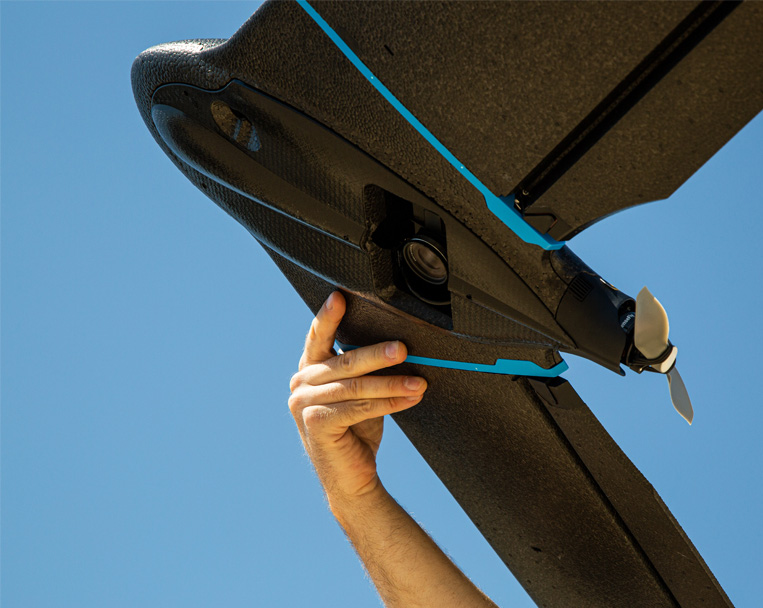
Affordable fixed-wing drone designed to meet the needs of surveyors, civil engineers and GIS professionals, thanks to its photogrammetry RGB built-in camera.
eBee Geo 45-minute flight time allows you to cover up to 160 ha / 395 ac at 2.5 cm / 1 in with RTK available.

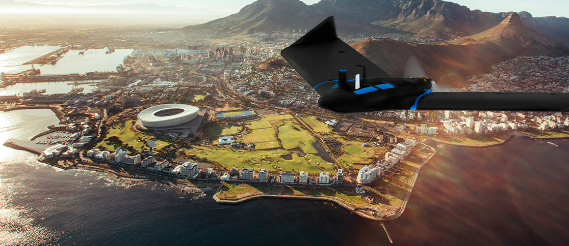
Rugged and intuitive to operate, eBee Geo makes surveying and mapping faster, safer and more efficient than terrestrial tools.

Simply hand-launch the drone, and it will autonomously fly and collect the data needed.
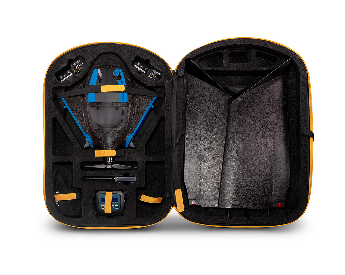
Easily transported in a backpack, eBee Geo can be deployed in just 3 minutes by one operator.
Automated and reliable data capture with the included flight management software.
All your gear in one spot with included drone backpack.
Rain cover and a laptop pocket.
4.6 kg / 10 lbs empty.
10 kg / 22 lbs when fully loaded.
PIX4Dmapper, PIX4Dmatic, PIX4Dcloud, PIX4Dreact, PIX4Dfields, PIX4Dsurvey, Agisoft Metashape, DroneDeploy, Bentley ContextCapture, SimActive, Esri ArcGIS Drone2Map and Trimble Business Center.
eBee Geo is a perfect entry into surveying and mapping for cost-conscious service providers, surveyors and GIS professionals with specific project requirements.
We set out to capture all these requirements into one affordable fixed-wing mapping drone with an RGB camera, to help you map smarter and optimize the ROI of your operations.

eBee Geo is backed by our industry-leading operational safety, even in the most complex projects.
The U.S. Federal Aviation Administration (FAA) drone registration data from 2016 to 2021 confirms that the eBee is the most used fixed-wing drone in the United States.
500,000 +eBee flight hours |
1,000,000 +eBee successful flights |
Preflight checksAutomated quick self-diagnosis before every flight |
12 yearsIndustry experience |
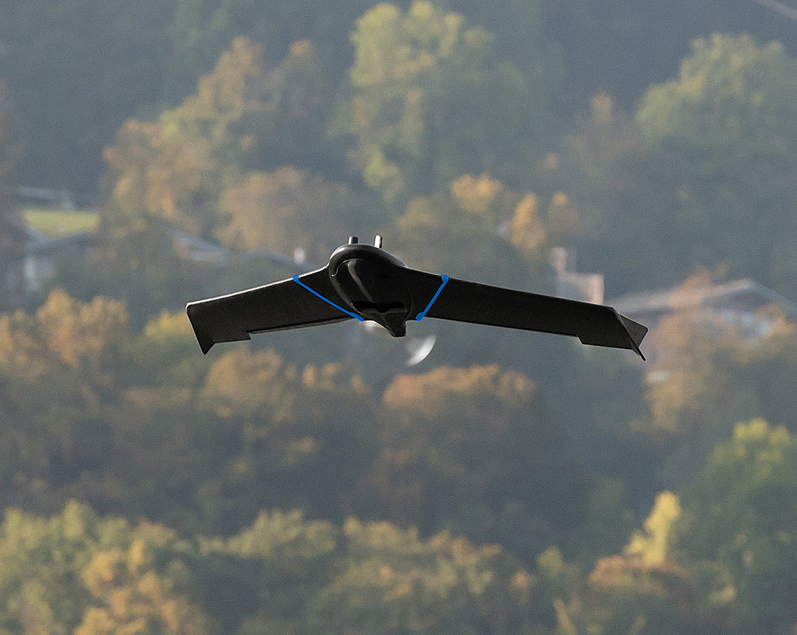
eBee Geo is designed to operate in hash conditions and perform continuous belly landings without damage.
Our team of engineers has optimized the drone’s airframe and the under-body skin to make it ultra-tough and able to operate in different terrains.

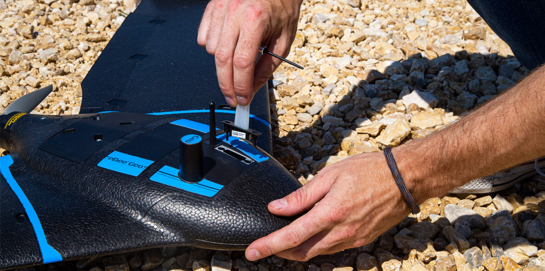
Easily make repairs in the field without stopping your project. The modular design of eBee Geo reduces downtime and maintenance costs.
If maintenance is needed, get your eBee Geo drone serviced locally, thanks to our global network of authorized service centers.
Impact tests proved safe flying around people.
No hard plastic part nor motor in the front part.
Safety protocols integrated into the flight planning software.
eBee Geo complements your surveying toolkit, elevating your professional capabilities. These are some benefits that the safe and reliable technology of fixed-wings brings to your operations.
eBee Geo users benefit from operational regulation advantages not available to heavier drones above 2 kg / 4.4 lbs. It also has remote ID approved by the FAA.
eBee Geo BVLOS flights are approved in Brazil, and Operations Over People (OOP) in Canada and in the United States. These advanced operations are essential to expanding your mapping capabilities.
The eBee Geo regulatory advantages and the fact that it is ready for advanced operations demonstrate that the platform is reliable and can easily perform complex missions.
eBee Geo comes with the senseFly S.O.D.A., a photogrammetry camera built for drone applications. It captures sharp aerial images to produce georeferenced orthomosaics, digital surface models (DSM) and point clouds

Available RTK allows you to achieve the high precision accuracy your project requires, down to 2.5 cm / 1 in without GCPs.

eBee Geo’s light weight allows users to operate safely within more regulatory frameworks worldwide and perform advanced operations, such as flying over people (OOP).
During the 45 minutes of flight, eBee Geo can cover an area up to 160 ha / 395 ac while flying at 120 m / 400 ft.
Need greater data precision? eBee Geo is available with Real-Time Kinematic (RTK), positioning GSD down to 2.5 cm / 1 in.
Designed to operate in harsh conditions thanks to its shock absorbent underbelly made of reinforced polypropylene woven mesh.
eBee Geo has Remote ID and the European C2 class identification label. The drone is prepared for the upcoming drone regulations in the U.S. and Europe.

